


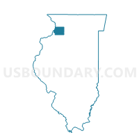
MONTMORENCY 1 Voting District, Whiteside County, Illinois
About
Outline

Summary
| Unique Area Identifier | 575215 |
| Name | MONTMORENCY 1 Voting District |
| County | Whiteside County |
| State | Illinois |
| Area (square miles) | 17.89 |
| Land Area (square miles) | 17.85 |
| Water Area (square miles) | 0.04 |
| % of Land Area | 99.75 |
| % of Water Area | 0.25 |
| Latitude of the Internal Point | 41.71543180 |
| Longtitude of the Internal Point | -89.66247100 |
Maps


Graphs
Select a template below for downloading or customizing gragh for MONTMORENCY 1 Voting District, Whiteside County, Illinois


Neighbors
Neighoring Voting District (by Name) Neighboring Voting District on the Map
- COLOMA 10 Voting District, Whiteside County, IL
- COLOMA 6 Voting District, Whiteside County, IL
- COLOMA 8 Voting District, Whiteside County, IL
- HAHNAMAN Voting District, Whiteside County, IL
- HAMILTON Voting District, Lee County, IL
- HARMON Voting District, Lee County, IL
- MONTMORENCY 2 Voting District, Whiteside County, IL
- NELSON Voting District, Lee County, IL
Top 10 Neighboring County Subdivision (by Population) Neighboring County Subdivision on the Map
- Coloma township, Whiteside County, IL (11,371)
- Montmorency township, Whiteside County, IL (2,612)
- Nelson township, Lee County, IL (874)
- Hahnaman township, Whiteside County, IL (399)
- Harmon township, Lee County, IL (378)
- Hamilton township, Lee County, IL (205)
Top 10 Neighboring Elementary School District (by Population) Neighboring Elementary School District on the Map
- Rock Falls Elementary School District 13, IL (7,961)
- Montmorency Community Consolidated School District 145, IL (2,603)
- East Coloma School District 12, IL (2,582)
- Nelson Public School District 8, IL (358)
Top 10 Neighboring Secondary School District (by Population) Neighboring Secondary School District on the Map
Top 10 Neighboring Unified School District (by Population) Neighboring Unified School District on the Map
Top 10 Neighboring State Legislative District Lower Chamber (by Population) Neighboring State Legislative District Lower Chamber on the Map
Top 10 Neighboring State Legislative District Upper Chamber (by Population) Neighboring State Legislative District Upper Chamber on the Map
Top 10 Neighboring 111th Congressional District (by Population) Neighboring 111th Congressional District on the Map
Top 10 Neighboring Census Tract (by Population) Neighboring Census Tract on the Map
- Census Tract 17, Whiteside County, IL (3,269)
- Census Tract 14, Whiteside County, IL (2,334)
- Census Tract 18, Whiteside County, IL (2,196)
- Census Tract 8, Whiteside County, IL (2,189)
- Census Tract 7, Lee County, IL (2,002)